
Lake Powell is the second-largest reservoir in the United States, and “how much water is in it” has two answers: how much it can hold when full, and how much is actually behind Glen Canyon Dam today. The gap between those two numbers is the whole story of the Colorado River drought.
The short answer
At full pool — elevation 3,700 feet — Lake Powell can store about 25 million acre-feet of water, roughly 8 trillion gallons. That is the reservoir’s structural capacity, measured by a 2018 survey. What it holds right now is a different, smaller number that changes every day with snowmelt and dam releases, and the live tracker above carries it. Today the reservoir sits far below full, the result of a two-decade drought on the Colorado River.
How much water is in Lake Powell at each level
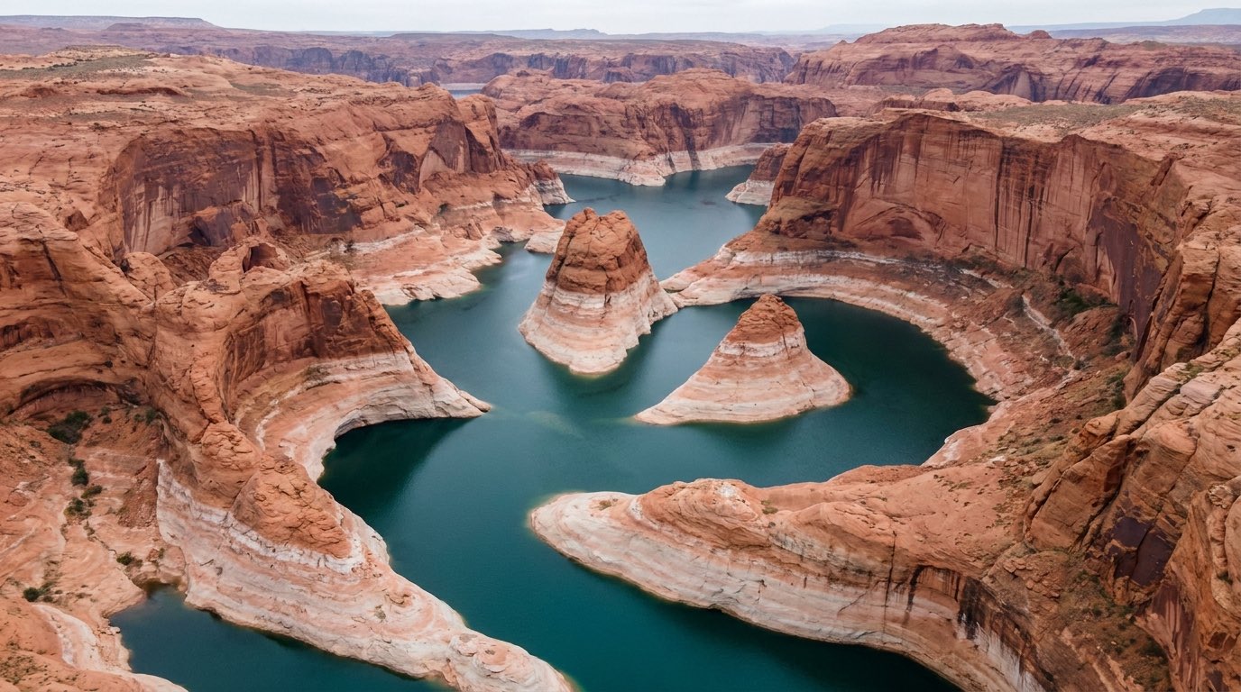
Because Lake Powell fills a deep, branching sandstone canyon, the amount of water tied to any given elevation is wildly uneven. A foot near the top of the pool is spread across a huge surface and holds far more water than a foot near the bottom, where the canyon pinches in. That is why the lake can lose 60 feet of elevation and still be more than half full by volume.
| Lake level | Water stored | What that level means |
|---|---|---|
| 3,700 ft | ~25.2 MAF | Full pool — maximum storage |
| 3,639 ft | ~15.8 MAF | About 60 ft down, roughly a third of capacity already gone |
| 3,490 ft | ~6.0 MAF | Minimum power pool — hydropower stops |
| 3,370 ft | ~1.9 MAF | Dead pool — nothing passes the dam by gravity |
(MAF = million acre-feet.) The rows are steeply uneven: dropping from full pool to 3,639 feet — just 61 feet — sheds about 9 million acre-feet, near 150,000 acre-feet for every foot. Down near dead pool, a foot is worth only about 34,000 acre-feet. For where today’s reading falls on that ladder, see the dead pool tracker and the 365-day water level chart.
What an acre-foot actually is
Reservoir water gets measured in acre-feet, not gallons, and the unit trips up almost everyone. One acre-foot is the water it takes to cover an acre of land — about a football field — one foot deep. In plain numbers that works out to 325,851 gallons, or roughly 1,233 cubic meters, per the U.S. Geological Survey.
Multiply that out and Lake Powell’s full-pool capacity of 25.16 million acre-feet comes to about 8.2 trillion gallons, or some 31 cubic kilometers of water. By the rough rule of thumb western water agencies use — an acre-foot covers a couple of average households for a year — a full Lake Powell would hold tens of millions of household-years of supply. That scale is exactly why two reservoirs, Powell and Lake Mead, were built to bank Colorado River water across wet and dry years.
Why the “full” number keeps shrinking
Ask what Lake Powell holds when full and you will see a few different figures, because the answer has quietly dropped over time. Every year the Colorado and San Juan rivers carry sediment into the still water, where it settles out and takes up space that used to hold water. The best measurement to date is a 2017–2018 survey by the USGS and the Bureau of Reclamation, which mapped the reservoir floor with multibeam sonar and lidar.
| Survey | Full-pool capacity |
|---|---|
| Original design (1963) | ~27.0 MAF |
| 1986 sonar resurvey | ~26.2 MAF |
| 2018 sonar + lidar resurvey | 25.16 MAF |
The 2018 study pegged full-pool capacity at 25,160,000 acre-feet, down 1,833,000 acre-feet — 6.79 percent — since the dam closed in 1963, and off about 4 percent from the 1986 survey alone (USGS). That is an average of roughly 33,000 acre-feet of storage lost to sediment every year, a slow lowering of the ceiling that runs underneath the year-to-year drama of drought.
One footnote worth knowing: you will also see Lake Powell’s full-pool capacity given as about 24.3 million acre-feet. That is an older operational figure that predates the 2018 resurvey, and it is still the number behind most “percent full” reporting, including the tracker above. The 2018 sonar-and-lidar survey is the more precise physical measurement; the older figure lingers in day-to-day operations, so a percentage worked out from one will land a point or two off the other. It is the same water measured two ways, not a real change in the reservoir.
Where the water goes even when it’s full
Storage does not just sit there. Lake Powell sheds water through two channels that have nothing to do with dam releases. Evaporation pulls roughly 70 inches off the surface in a year; combined evaporation from Powell and Mead when both are full has been estimated near 1.14 million acre-feet annually, which puts Powell’s share in the hundreds of thousands of acre-feet (Center for Colorado River Studies). The lake also soaks water into the porous Navajo sandstone that forms its canyon walls — bank seepage that research summaries put in the hundreds of thousands of acre-feet a year, water that may not return to the river on any useful timescale.
Add them up and Lake Powell can quietly lose on the order of a million acre-feet a year to evaporation and seepage alone, before a single release. Those losses are part of why some groups argue for consolidating Colorado River storage in one reservoir instead of spreading it thin across two half-empty ones.
Is Lake Powell or Lake Mead bigger?
By storage capacity, Lake Mead edges it out. Mead holds roughly 26 million acre-feet at full pool to Powell’s 25.16 million, which makes Mead the largest reservoir in the United States and Powell the second. The two are close enough that they trade the “bigger” title depending on the survey and the year’s sediment. Together they can bank around 50 million acre-feet — nearly two years of the river’s average flow — which was the entire point of building both. For a live, side-by-side look at how full each one is today, see Lake Powell vs. Lake Mead, and for the operational stakes, which reservoir is in worse shape.
When was Lake Powell last full?
Lake Powell has been full exactly once in any lasting sense. It first touched full pool of 3,700 feet in June 1980, about 17 years after Glen Canyon Dam closed the canyon in 1963 — that is how long it took the river to fill 25-plus million acre-feet of empty sandstone. Three years later, the enormous 1983 runoff pushed the lake to its all-time high of 3,708.34 feet on July 14, 1983, more than 8 feet over full pool and something like a million acre-feet above design capacity, enough to send water down the spillways.
It has not come near full since the 1980s. The drought that set in after 2000 drove the reservoir to 3,519.92 feet in April 2023, and it fell below that mark again in August 2026. For the full arc, see how low Lake Powell has gotten and the water level history from 1963 to today. For why the water fell so far, start with why Lake Powell is so low.
Sources
- U.S. Geological Survey — Elevation–area–capacity relationships of Lake Powell in 2018 and estimated loss of storage capacity since 1963 (SIR 2022–5017) (25.16 MAF full-pool capacity; 1.83 MAF / 6.79% sediment loss since 1963)
- U.S. Geological Survey — Lake Powell’s storage capacity updated for the first time since 1986
- U.S. Bureau of Reclamation — Glen Canyon Dam / Lake Powell water operations (operational elevations and storage tiers)
- Center for Colorado River Studies — Reservoir evaporation (evaporation estimates for Powell and Mead)
- Western Resource Advocates — The Story of Lake Powell (storage at 3,639 ft)
- U.S. Geological Survey — Water Science School (acre-foot to gallons conversion)
- National Park Service — Glen Canyon NRA, Changing Lake Levels