
Lake Powell Water Level Today
Current Lake Powell Water Level
Capacity
21.4%
Storage
5.21 MAF
Below Full
181.0 ft
Source: USBR Hydromet 919
Official end-of-day elevation at the Glen Canyon Dam forebay. The U.S. Bureau of Reclamation publishes one finalized reading per day; this refreshes automatically.
0.12 ft higher today
25.46 ft lower today
5.21 MAF of 24.322 MAF total storage
Above Power Pool
29 ft
Min Power: 3,490 ft
7-Day Change
-0.01 ft
Falling
30-Day Change
+1.99 ft
Upward trend
Water Storage
5.21 MAF
21.4% capacity
Water Level Gauge
Snowpack, Inflow & Releases
Live USBR flowWhat's coming in and going out — the three numbers that drive next month's elevation.
112%
of median (NRCS, April 5, 2026)
10,522 cfs
USBR daily
6,652 cfs
Glen Canyon
Net change: +3,870 cfs — inflow minus release.
April–July forecast: 7.9 MAF (105% of average, as of April 5, 2026).
Inflow & release are official USBR daily values for October 12, 2026. Snowpack and forecast are seasonal NRCS/USBR estimates.
Boat Ramp Status
0
Open
1
At Risk
3
Limited
8
Closed
30-Day Trend
Low 3,516.62 ft · High 3,519.04 ft
How Today's Level Compares: Tiers & Capacity
Lake Powell is currently at 3,519 ft (21.4% capacity). Here's where that sits across the operational tiers the Bureau of Reclamation uses to manage Glen Canyon Dam.
3,700 ft
~100% capacity
Maximum storage (24.32 MAF). Last reached in 1983.
Today is 181.0 ft below this tier
3,575 ft
~58% capacity
Above this, releases balance Powell with Lake Mead.
Today is 56.0 ft below this tier
3,525 ft
~35% capacity
Annual releases adjusted based on storage outlook.
Today is 6.0 ft below this tier
3,490 ft
~24% capacity
Below this, hydropower generation at Glen Canyon Dam stops.
Today is 29.0 ft above this tier
3,370 ft
~0% capacity
Water can no longer flow through the dam's outlets.
Today is 149.0 ft above this tier
Verify with official government sources
What You Need to Know
Lake Powell currently sits at 3,519 feet, which is 21.4% of its total capacity. While this remains well below Full Pool (3,700 ft), the lake is 29 feet above the minimum power pool elevation of 3,490 ft, ensuring Glen Canyon Dam continues generating hydroelectric power.
Over the past 30 days, the lake has risen 1.99 feet, reflecting spring runoff from the Colorado River watershed. Lake Powell generally peaks with snowmelt in early summer, then declines through fall.
Emerging Destinations
Hidden Beaches
Lower water reveals sandy beaches and coves once submerged — perfect for camping and swimming.
Canyon Exploration
Shallow side canyons become accessible by kayak and paddleboard, offering stunning slot canyon experiences.
Can You Still Boat on Lake Powell?
Yes — boating is available at current levels. Here's a quick checklist:
- 0 of 12 launch ramps are fully operational — more allow launching with limits (see the Boat Ramps tab)
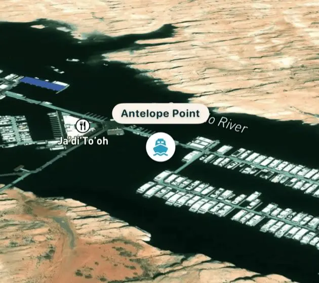
- Wahweap, Antelope Point, and Bullfrog marinas remain in service — call ahead for launch and slip options
- Houseboats can navigate the main channel and most major coves
- Depth at dam: 387 feet — ample for all vessels
- Some upper-lake ramps (Hite, Dirty Devil, Farley Canyon) remain closed
- Jet skis and smaller craft can explore shallow side canyons
Marina & Services
Wahweap Marina — Full-service marina near Page, AZ. Fuel, boat rentals, lodging, dining, and guided tours available year-round.
Antelope Point Marina — Offers houseboat rentals, wet slips, and fuel. Convenient access to Antelope Canyon by water.
Bullfrog Marina — Utah's largest Powell marina. Full services including fuel, store, and lodging at Defiance House Lodge.
Halls Crossing — Ferry terminal connecting to Bullfrog. Limited services; fuel and small store available.
Houseboating at Current Levels
Houseboating on Lake Powell is still a fantastic experience. The main channel offers plenty of depth and width for safe navigation. Here are some tips:
- Stick to the main channel and well-known coves for overnight beaching
- Carry an offline GPS map (like Lake Powell Navigator) so you know where you are after cell service drops
- Avoid shallow side canyons unless you've confirmed depth
- Beach on sandy shorelines — avoid rocky areas exposed by lower water
- Book early: houseboat rentals fill up fast for the summer season
Driving Distances to Lake Powell
Las Vegas, NV
4h 30m (275 mi)
Phoenix, AZ
4h 45m (280 mi)
Salt Lake City, UT
4h 30m (375 mi)
Denver, CO
8h 30m (540 mi)
Flagstaff, AZ
2h 15m (135 mi)
Moab, UT
3h 30m (200 mi)
Frequently Asked Questions
What is the current water level at Lake Powell?
Lake Powell is currently at 3,519 feet elevation, which is 21.4% of full capacity.
Can I still launch a boat at Lake Powell?
Yes. 0 of 12 public launch ramps are fully open right now, and several more allow launching with limits. Check the Boat Ramps tab for ramp-by-ramp status before you tow.
What is Full Pool at Lake Powell?
Full Pool is 3,700 feet elevation, representing the maximum water storage capacity of 24.322 million acre-feet.
What is Dead Pool at Lake Powell?
Dead Pool is 3,370 feet elevation, the level at which water can no longer flow through Glen Canyon Dam.
Is Lake Powell rising or falling?
Lake Powell has risen 1.99 feet over the past 30 days. The lake typically rises with snowmelt in late spring and declines through summer and fall.
Can you still houseboat on Lake Powell?
Absolutely. The main channel and most major coves have ample depth for houseboats. All major marinas are operational.
How deep is Lake Powell right now?
At the dam, Lake Powell is currently 387 feet deep (elevation 3,519 ft minus riverbed at 3,132 ft).
Where does Lake Powell water level data come from?
Water level data is sourced from the U.S. Bureau of Reclamation (USBR) and updated daily. Boat ramp status is maintained by the National Park Service (NPS).
Stay Updated
Get weekly Lake Powell water level updates delivered to your inbox.
Data Sources:
Water level data from the U.S. Bureau of Reclamation (USBR). Boat ramp status from the National Park Service (NPS) at Glen Canyon National Recreation Area.
This site is informational only. Always verify conditions with official sources before your trip.