The Lake Powell Water Level app
The Lake Powell Water Level app for iPhone shows today's official U.S. Bureau of Reclamation elevation — 3,519.03 ft as of October 8, 2026 — plus live launch status for all 13 boat ramps, decades of history and trends, inflow versus Glen Canyon Dam releases, and push alerts the moment the lake rises or falls. Free to download.

Launching soon on the App Store — the download link goes live here the moment it's approved.
Official USBR daily data · NPS ramp thresholds · Free to download
How full is Lake Powell right now?
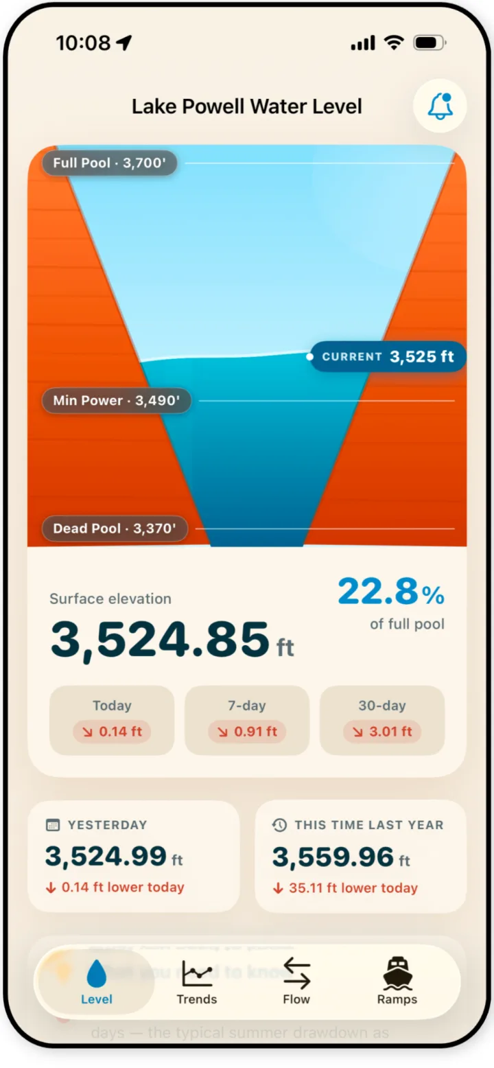
The home gauge shows Lake Powell's surface elevation to the hundredth of a foot, its percent of full pool, and how much it has moved today, over the past 7 days, and over the past 30 days — with yesterday and this-time-last-year for context.
Live launch status for all 13 boat ramps
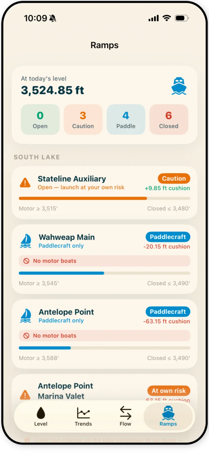
See which ramps are open, caution, paddlecraft-only, or closed at today's level — each with the elevation where it closes and how much cushion is left above its National Park Service minimum.
- Open / caution / closed counts at a glance
- Each ramp's cushion above its NPS minimum, in feet
- Separate motorized and paddlecraft thresholds
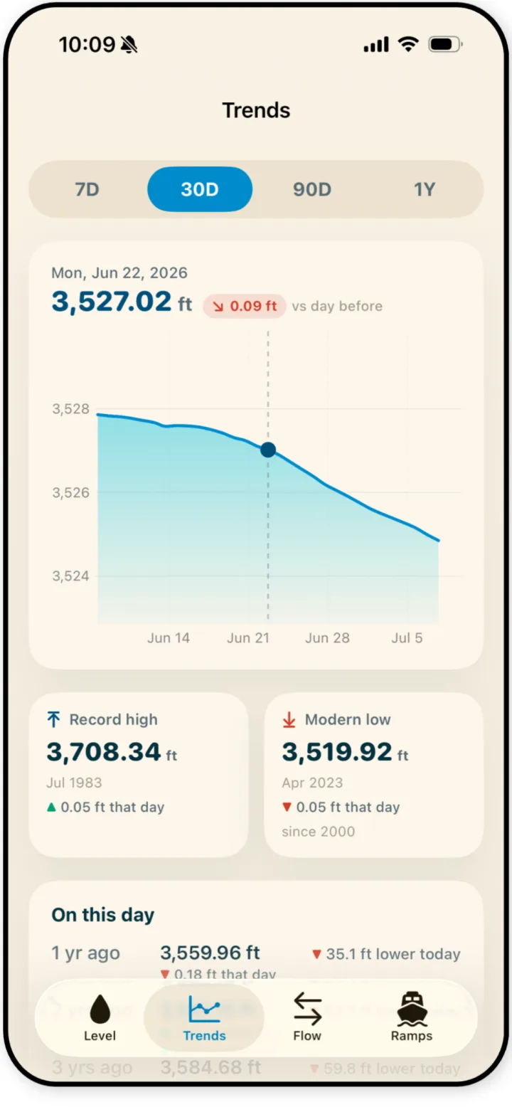
Trends you can actually read
Chart the lake from the last 7 days out to a full year. Tap any day to see its exact elevation and the change from the day before.
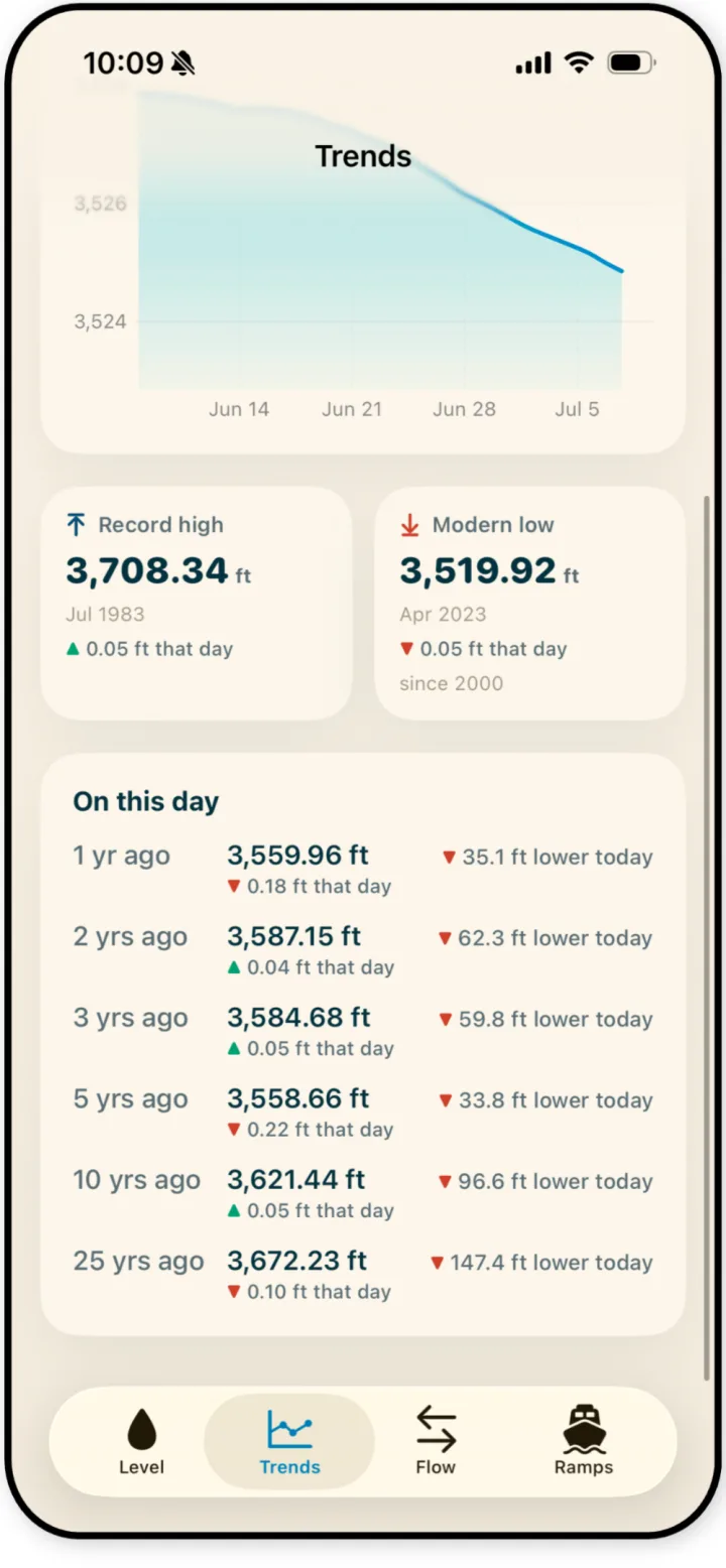
How today compares to years past
See the lake's level on this date 1, 2, 3, 5, 10, and 25 years ago, alongside the all-time record high and the modern low — so today's number always has context.
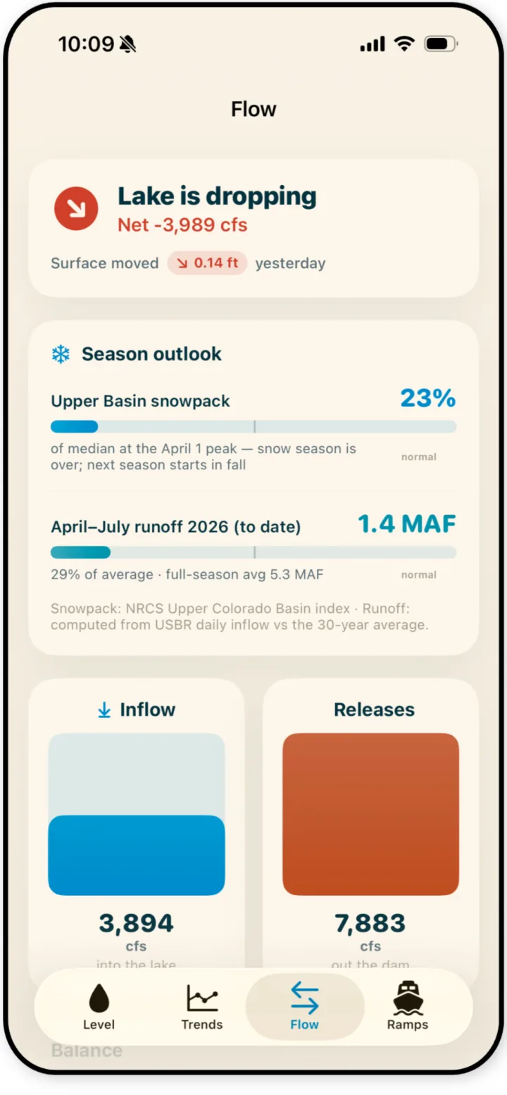
Net flow, snowpack & runoff on one screen
Know whether the lake is rising or dropping in cfs, how Upper Basin snowpack compares to the median, how April–July runoff stacks up against average, and how inflow measures against Glen Canyon Dam releases.
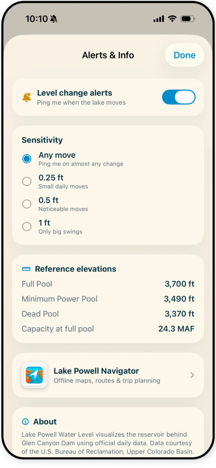
Never miss a big level change
Turn on push alerts at the sensitivity you choose — any move, 0.25 ft, 0.5 ft, or 1 ft — and the app watches the daily reading for you. Key reference elevations (full pool, minimum power pool, dead pool) are built in.
Do you need the app if you use this site?
Not necessarily. This website and the app run on the same official USBR and NPS data, refreshed daily — you can check the live tracker, today's level, and boat ramp status right here in any browser, free. The app adds two things: push alerts when the lake moves, and a faster one-thumb experience for checking conditions out on the water.
Lake Powell app FAQ
Is there an app that shows Lake Powell's water level?
Yes. Lake Powell Water Level for iPhone shows the official U.S. Bureau of Reclamation reading — one finalized end-of-day elevation per day — plus launch status for all 13 boat ramps, historical trends, inflow and dam releases, and push alerts when the lake moves.
What does the Lake Powell Water Level app include?
Five main screens: the current elevation and percent of full pool, live launch status for all 13 boat ramps, trend charts from a week out to a year, how today compares to past years and the record high/low, and net flow with snowpack and runoff context — plus customizable push alerts for level changes.
Where does the app get its data?
The same official sources as this website: daily elevation readings from the U.S. Bureau of Reclamation (USBR), ramp minimum-safe elevations from the National Park Service (NPS), and Upper Colorado Basin snowpack from the NRCS snow-survey index.
Can the app alert me when the lake rises or falls?
Yes — level-change push alerts with selectable sensitivity: any move, 0.25 ft, 0.5 ft, or 1 ft.
Is the Lake Powell Water Level app free?
Yes — free to download on iPhone.
Is there an Android version?
Not yet — iPhone first. Android users get the same live data on this website in any browser.
When can I download it?
It's rolling out on the App Store now; this page gets the download link the moment the listing is live. Get email updates and we'll let you know.
Take Lake Powell with you
Today's official level, all 13 ramps, and level-change alerts — in your pocket on the water.
Launching soon on the App Store — the download link goes live here the moment it's approved.
Updated October 8, 2026 · Elevation data: U.S. Bureau of Reclamation (USBR). Ramp status: National Park Service (NPS). Informational only — verify conditions with official sources.