
America’s biggest lakes are almost all engineered. Ranked by how much water they can hold, the top of the list belongs to two Colorado River reservoirs that happen to be sitting closer to empty than anything else on it.
The short answer
Lake Mead is the largest man-made lake in the United States, with a full-pool capacity around 26.1 million acre-feet. Lake Powell is second at 25.16 million. The next three — Sakakawea, Oahe, and Fort Peck — are all Missouri River reservoirs in the northern Great Plains, and together they hold more water than Mead and Powell combined.
The ranking below uses total storage capacity at full pool, the volume each reservoir was built to hold. That is the measure most agencies publish and the one most lists mean by “largest.” Rank by surface area instead and the order changes completely, which is covered further down.
The 10 largest man-made lakes in the U.S.
| # | Lake | Dam / river | State(s) | Capacity (acre-feet) | Surface area (acres) |
|---|---|---|---|---|---|
| 1 | Lake Mead | Hoover Dam, Colorado | NV / AZ | 26,100,000 | 157,418 |
| 2 | Lake Powell | Glen Canyon Dam, Colorado | UT / AZ | 25,160,000 | 159,200 |
| 3 | Lake Sakakawea | Garrison Dam, Missouri | ND | 23,451,000 | 383,000 |
| 4 | Lake Oahe | Oahe Dam, Missouri | SD / ND | 22,983,000 | 386,000 |
| 5 | Fort Peck Lake | Fort Peck Dam, Missouri | MT | 18,463,000 | 245,000 |
| 6 | Franklin D. Roosevelt Lake | Grand Coulee Dam, Columbia | WA | 9,715,000 | 81,991 |
| 7 | Lake Cumberland | Wolf Creek Dam, Cumberland | KY | 6,089,000 | 50,250 |
| 8 | Lake Koocanusa | Libby Dam, Kootenai | MT | 5,869,000 | 46,500 |
| 9 | Lake Francis Case | Fort Randall Dam, Missouri | SD | 5,293,000 | 102,000 |
| 10 | Toledo Bend Reservoir | Toledo Bend Dam, Sabine | TX / LA | 4,477,000 | 181,600 |
1. Lake Mead — 26.1 million acre-feet
Hoover Dam closed on the Colorado River in the mid-1930s and backed water up more than 100 miles through Black Canyon, creating the largest reservoir the country has ever built. The Bureau of Reclamation partitions that storage into functional zones — roughly 1.5 million acre-feet reserved for flood control, 2.5 million for sediment, and 18.4 million for joint use across water supply, irrigation, and power.
Full pool sits at elevation 1,229 feet. The lake covers 157,418 acres at capacity, according to the National Park Service. Older rankings often cite a capacity near 28.9 million acre-feet, a figure Reclamation quotes for elevation 1,221.4 feet under an earlier survey; the roughly 26.1 million figure matches the percent-full numbers Reclamation publishes today.
2. Lake Powell — 25.16 million acre-feet
Glen Canyon Dam’s diversion tunnels closed in 1963, and Lake Powell flooded nearly 200 miles of canyon upstream. Its capacity has been revised downward twice by sediment. A 2017–2018 topobathymetric survey by the USGS and Reclamation put total storage at 25,160,000 acre-feet — a loss of 1,833,000 acre-feet, or 6.79%, since 1963, working out to roughly 33,000 acre-feet a year.
That same survey measured the lake at 159,200 acres at full pool, which makes Lake Powell fractionally larger than Lake Mead by surface area while holding about a million acre-feet less. The canyon geometry explains both: deep, narrow, and enormously long-shored. Today’s elevation is in the callout above, and the last 365 days sit on the water level chart. For the head-to-head, see Lake Powell vs. Lake Mead and which is in worse shape.
3. Lake Sakakawea — 23.45 million acre-feet
The largest reservoir outside the Colorado River basin sits behind Garrison Dam in central North Dakota, which closed on April 15, 1953. The Army Corps of Engineers gives Lake Sakakawea a storage capacity of 23.451 million acre-feet and a surface area of 383,000 acres at its maximum operating pool of 1,854 feet (USACE Missouri River System Description).
Note the ordering here, because most published lists get it wrong: Sakakawea edges out Lake Oahe by about half a million acre-feet in the Corps’ own numbers, and USACE itself describes Sakakawea as the third largest man-made lake in the country.
4. Lake Oahe — 22.98 million acre-feet
Oahe Dam closed on August 3, 1958, and the reservoir now stretches roughly 230 miles from Pierre, South Dakota, to near Bismarck, North Dakota. Capacity is 22.983 million acre-feet, with 386,000 acres of surface at maximum operating pool — the largest water surface of any man-made lake in the United States (USACE).
Oahe therefore holds the odd distinction of ranking fourth by volume and first by area. Prairie reservoirs spread; canyon reservoirs stack.
5. Fort Peck Lake — 18.46 million acre-feet
Fort Peck is the oldest of the Missouri mainstem dams, closed on June 24, 1937, and still the largest hydraulically filled dam in the country. The lake holds 18.463 million acre-feet across 245,000 acres at maximum operating pool (USACE).
Fort Peck, Garrison, and Oahe together account for nearly 90% of the Missouri system’s storage, which is why Corps drought decisions in Montana and the Dakotas move so much water.
6. Franklin D. Roosevelt Lake — 9.72 million acre-feet
Behind Grand Coulee Dam on the Columbia River, Lake Roosevelt marks a steep drop-off from the top five. Reclamation’s reservoir survey gives a gross capacity of 9,715,346 acre-feet with 81,991 acres of surface, of which 5,349,560 acre-feet is active storage available for operations.
The gap between those two numbers is worth noticing — it is the same distinction that scrambles most published rankings, covered below.
7. Lake Cumberland — 6.09 million acre-feet
Lake Cumberland formed when Wolf Creek Dam was completed for flood-control operation in 1950, and the Corps has described it as the largest reservoir east of the Mississippi River by volume. Its own project page calls it “101 miles long in length” with “1,255 miles of shoreline, providing a total storage capacity of 6,089,000 acre-feet” (USACE). Surface area runs 50,250 acres at the 723-foot summer pool.
8. Lake Koocanusa — 5.87 million acre-feet
Libby Dam on the Kootenai River in northwest Montana backs water 90 miles upstream and across the international border into British Columbia — the name is a portmanteau of Kootenai, Canada, and USA. Gross capacity is about 5,869,000 acre-feet over roughly 46,500 acres, per Corps documentation for the project.
9. Lake Francis Case — 5.29 million acre-feet
Fort Randall Dam, completed in 1953, is the fourth of the six Missouri mainstem projects to appear on this list. Capacity is 5.293 million acre-feet across about 102,000 acres at maximum operating pool (USACE).
10. Toledo Bend Reservoir — 4.48 million acre-feet
The tenth spot goes to a reservoir straddling the Sabine River on the Texas–Louisiana line. The Texas Water Development Board puts conservation capacity at 4,477,000 acre-feet over 181,600 acres — a surface area larger than every lake on this list except Sakakawea, Oahe, and Fort Peck, spread across water averaging well under 30 feet deep.
Ranked by surface area, the list reorders
Volume and area measure different things, and the two rankings barely agree. Sorting the same ten lakes by the water they cover:
| # | Lake | Surface area (acres) | Rank by volume |
|---|---|---|---|
| 1 | Lake Oahe | 386,000 | 4 |
| 2 | Lake Sakakawea | 383,000 | 3 |
| 3 | Fort Peck Lake | 245,000 | 5 |
| 4 | Toledo Bend Reservoir | 181,600 | 10 |
| 5 | Lake Powell | 159,200 | 2 |
| 6 | Lake Mead | 157,418 | 1 |
| 7 | Lake Francis Case | 102,000 | 9 |
| 8 | Franklin D. Roosevelt Lake | 81,991 | 6 |
| 9 | Lake Cumberland | 50,250 | 7 |
| 10 | Lake Koocanusa | 46,500 | 8 |
The two Colorado River giants fall to fifth and sixth. Toledo Bend jumps from tenth to fourth. Basin shape drives the whole difference: Oahe and Sakakawea are shallow sheets of water lying across open prairie, while Mead and Powell are narrow floods filling deep rock.
There is a practical consequence. Wide, shallow reservoirs lose far more water to evaporation per acre-foot stored, and the Corps budgets those losses explicitly in its Missouri River operating plans.
Why published rankings contradict each other
Three definitional traps account for nearly every disagreement between lists.
- Gross versus conservation capacity. Gross capacity counts every storage zone, including flood-control space that is deliberately kept empty. Conservation or active capacity counts only water available for delivery. Amistad Reservoir on the Rio Grande appears near 5.7 million acre-feet on gross figures — top-ten territory — but its conservation capacity measured 3,226,704 acre-feet in a 2014 survey, and it is a binational reservoir where the United States holds only 56.2% of that storage (Texas Water Development Board). On conservation figures it does not make the top ten.
- Survey vintage. Sediment quietly shrinks reservoirs. Lake Powell’s official capacity fell from roughly 27 million acre-feet at closure to 25.16 million by the 2018 survey. A list citing 1963 design numbers is describing a lake that no longer exists.
- Natural lakes mixed in. Some rankings fold in Lake Okeechobee or the Great Lakes. This one covers only impoundments — lakes that exist because a dam was built.
How full are they right now?
Capacity is what a reservoir can hold. Storage is what it actually holds, and in the Colorado River basin the gap has become the story.
Reclamation’s weekly hydrologic update for July 19, 2026 put Lake Mead at 1,041.81 feet and 27% full, with 7,103 thousand acre-feet in storage. Lake Powell’s share of that system appears in the callout at the top of this post, which re-reads Reclamation’s official gauge every day. Total Colorado River system contents stood at 19,131 thousand acre-feet, 33% of capacity — down from 39% a year earlier.
The Missouri reservoirs sit in a different position, though not a comfortable one. The Corps’ reservoir bulletin for July 21, 2026 shows Fort Peck at 2,224.17 feet, Garrison at 1,828.01, and Oahe at 1,597.20 — each below the base of its annual flood-control zone, meaning all three upstream giants were carrying less than their operating target heading into midsummer.
So the two largest man-made lakes in America are also, by a wide margin, its emptiest. Lake Powell’s current reading is in the callout at the top of this post and on the live tracker; how close the drawdown comes to the operational floor is tracked on the dead pool page.
Sources
- U.S. Army Corps of Engineers — Missouri River Mainstem Reservoir System Description (PDF) (capacities and surface areas for Fort Peck, Garrison, Oahe, Fort Randall; 72.4 MAF system total)
- U.S. Army Corps of Engineers — Mainstem and Tributary Reservoir Bulletin (PDF) (July 21, 2026 elevations and storage zones)
- U.S. Bureau of Reclamation — Lower Colorado Weekly Hydrologic Update (PDF) (July 19, 2026 Lake Mead and Lake Powell elevation, storage, percent full)
- U.S. Bureau of Reclamation — Hoover Dam / Lake Mead FAQs (Lake Mead storage allocations and elevations)
- U.S. Geological Survey — Elevation–Area–Capacity Relationships of Lake Powell, SIR 2022-5017 (25.16 MAF capacity, 159,200-acre surface, sediment loss since 1963)
- National Park Service — Lake Mead NRA FAQs (157,418-acre surface area at full capacity)
- U.S. Army Corps of Engineers — Wolf Creek Dam (Lake Cumberland capacity, length, shoreline, 1950 completion)
- Texas Water Development Board — Amistad Reservoir and Toledo Bend Reservoir (conservation capacities and surface areas)
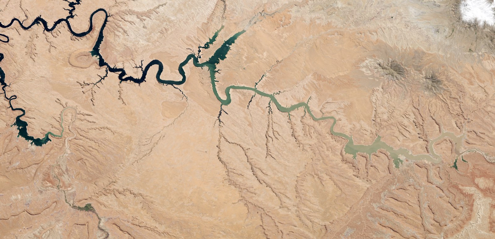
Hero image: Lake Powell Half Empty by NASA Goddard Space Flight Center — Landsat 8, May 13, 2014 — public domain, via Wikimedia Commons (cropped).

.jpg)