
Whether you can launch at Lake Powell comes down to one number: the lake’s elevation versus the concrete’s reach. As the reservoir has fallen, most of its public boat ramps have gone dry, and the ones still usable shift from year to year. The water level each ramp needs is below, ramp by ramp, sourced to the National Park Service.
The short answer
Most Lake Powell boat ramps are closed to motorized launching at today’s low elevation. Each ramp has an NPS minimum safe elevation — the lake level below which a trailer can no longer reach the water safely — and status flips as the lake crosses that mark. At recent levels, the Stateline Auxiliary ramp near Wahweap is the main motorized launch, and Bullfrog North is the last one on the north lake for boats under 25 feet. Compare today’s reading in the callout above to the thresholds below, and check the live boat ramp status before you tow.
The water level each ramp needs
These are the NPS minimum safe elevations for motorized launching, highest to lowest. A ramp above the current lake level is out of the water; one below it may still be usable. The current reading lives in the callout above, never in this table — these are fixed engineering marks, not today’s number.
| Boat ramp | Area | NPS minimum (motorized) | Note |
|---|---|---|---|
| Hite | Hite (UT) | ~3,650 ft | Out of water — the lake no longer reaches it |
| Antelope Point (public) | Antelope Point (AZ) | 3,588 ft | Concessioner business ramp minimum is 3,535 ft |
| Bullfrog Main | Bullfrog (UT) | 3,578 ft | Utah’s largest marina |
| Halls Crossing | Halls Crossing (UT) | 3,557 ft | Ferry terminal inoperable below ~3,575 ft |
| Wahweap Main | Wahweap (AZ) | 3,545 ft | Fully open for launching above 3,550 ft |
| Bullfrog North | Bullfrog (UT) | 3,525 ft | Boats under 25 ft; the north lake’s last motorized ramp |
| Stateline Auxiliary | Wahweap (AZ) | 3,515 ft | Extended ramp; plate mats added at ~3,524 ft |
Paddlecraft rules are looser: kayaks and paddleboards can hand-launch at several ramps — including Wahweap Main and Lone Rock Beach — that are closed to motors, because a paddler doesn’t need a trailer to reach deep water.
How a boat ramp “closes” as the lake drops
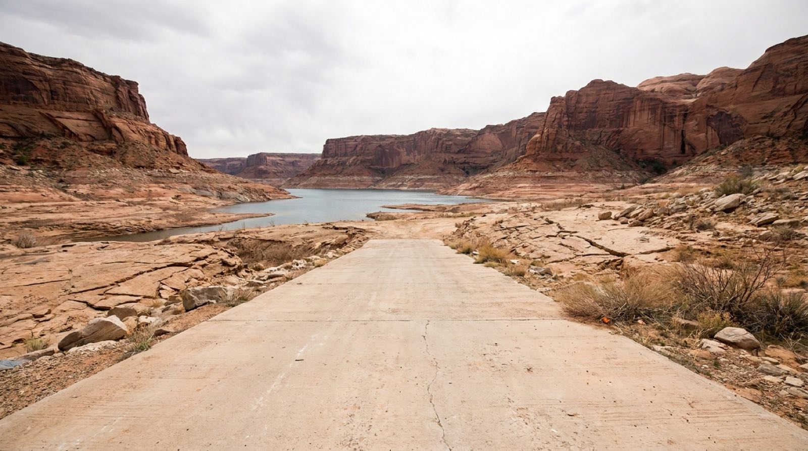
A launch ramp is a fixed concrete slab poured down the original shoreline, and it only reaches so far. As Lake Powell recedes, the waterline eventually slides past the bottom edge of the concrete. What’s left is a drop-off, soft sediment, or bare rock — ground a trailer and tow vehicle can’t handle. When the lake falls below a ramp’s engineered minimum, the Park Service closes it to launching.
The NPS buys time with extensions. At several ramps, crews lay steel “boilerplate” mats or plate extensions past the end of the concrete to let boats reach the water a few feet lower. That’s how the Stateline Auxiliary ramp has stayed open through the recent lows, and why Bullfrog North runs on a single west lane over steel matting with a steep drop-off at the end. These are stopgaps — they lower the working elevation a little, not the fundamental problem.
Ramp by ramp
Wahweap (Arizona). The Wahweap Main ramp closes to motorized launching below 3,545 ft and is fully open above 3,550 ft. When the main ramp is out of reach, the extended Stateline Auxiliary ramp takes over as the primary motorized launch, down to an NPS minimum of 3,515 ft with plate mats added around 3,524 ft.
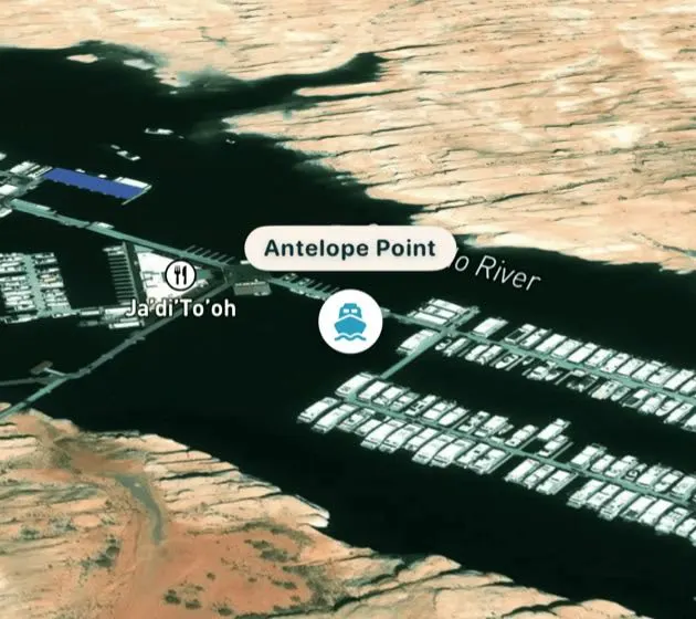
Antelope Point (Arizona). The public launch ramp has a high minimum of 3,588 ft, so it sits above recent lake levels. The concessioner-operated business ramp reaches lower, to 3,535 ft, and the Antelope Point Marina runs a valet boat launch for smaller vessels — call ahead, since the size limit tightens as the lake drops.
Bullfrog and Halls Crossing (Utah). On the north lake, Bullfrog Main — Utah’s largest marina ramp — closes to motorized launching below 3,578 ft. Bullfrog North, an extended ramp nearby, keeps launching boats under 25 feet down to about 3,525 ft, making it the north lake’s last motorized option at low water. Halls Crossing closes below 3,557 ft, and its ferry terminal goes inoperable below roughly 3,575 ft.
Hite (Utah). At the far north end, Hite has been out of the water for years — Lake Powell simply no longer reaches the old ramp. The NPS has floated plans for a new low-water ramp in the area, but none is operational there yet.
Which ramps are open right now
Ramp status is not a fixed fact — it moves with the lake level and with NPS operational calls, sometimes week to week. The live boat ramp status page computes each ramp’s condition daily from the official USBR reading against the thresholds above, so it’s the number to trust before a trip. As a rule of thumb at recent lows, motorized boaters launch at Stateline Auxiliary near Wahweap and at Bullfrog North on the north lake; most other ramps are dry or paddlecraft-only.
For how far the lake has fallen to get here, see how low is Lake Powell and the 365-day water level chart.
When will the ramps reopen?
A ramp reopens when the lake climbs back above its minimum safe elevation, so the order of recovery follows the table: the lowest ramps come back first. A single well-above-average winter can raise Powell roughly 30–65 feet in one runoff season — the 2023 snowpack lifted it about 65 feet off its record low — which would restore Stateline and Bullfrog North to full operation well before higher ramps like Bullfrog Main (3,578 ft) or Halls Crossing (3,557 ft).
The honest read of the forecast is that a return to broadly open ramps depends on sustained wet years, not one good winter. Most projections expect the reservoir to stay well below the levels that reopen the high ramps. For where the lake is actually headed, watch the live callout above and the forecast page, and see why Lake Powell is so low for the underlying drivers.
Sources
- National Park Service — Glen Canyon NRA, Changing Lake Levels (the master ramp-by-ramp minimum-elevation table)
- National Park Service — Glen Canyon ramp pages: Stateline Auxiliary, Bullfrog Main, Bullfrog North, Antelope Point Public
- U.S. Bureau of Reclamation — Glen Canyon Dam / Lake Powell operations (official elevation)
- NOAA Colorado Basin River Forecast Center — Colorado River inflow forecasts (runoff outlook behind ramp recovery)